
© 2013 Oceanic Imaging Consultants, Inc.
Service + Software for Seafloor Mapping

Archive / 2007

June 2007
GeoDAS/Sidescan Product Demonstrations at SeaWork 2007
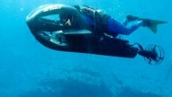
OIC, in cooperation with DSME Utech, Ltd will be conducting on-water demonstrations and providing free training on the operations of GeoDAS with the new lightweight DSME Utech
S-150 sidescan sonar. Also check out OIC’s new Geo-Vu™, a wearable, wireless GeoDAS viewer! These training sessions will be conducted on board the Bill Conway, located at the Western dock, ABP Port of Southampton (fronting the SeaWork 2007 area) Wednesday and Thursday, June 13 & 14th from 11:00 AM to 1:00PM. Space to attend this training is available but limited; contact OIC at reed@oicinc.com or visit booth 209 to reserve space.
May 007
GeoDAS Demonstrations at U.S. Hydro 2007
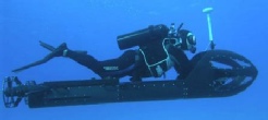
OIC, in cooperation with AzulMar Research,
LLC will be conducting on-water demonstrations and providing free training on the
operations of GeoDAS with the Imagenex DeltaT multibeam, and the new lightweight
DSME UTech S-150 sidescan sonar. Also check out OIC’s new Geo-Vu™, a wearable, wireless
GeoDAS viewer! These training sessions will be conducted 0.4 miles down the street
from the conference at the Waterside Marina on Tuesday and Wednesday, May 15 and
16 at 0930, 1100 and 1430 hours.
March 2007
New Software versions, new functionality!
CleanSweep Version 2.0 was officially released
at Ocean Business 2007, with inclusion of these new features:
- 3D Swath viewer featuring sidescan images draped over bathymetry, profile/point/surface rendering modes, multi-profile editor, sun illumination and vertical exaggeration.
- Export of geocoded targets to a database for sharing targets between CleanSweep projects.
- Multi-layer interactive mosaic engine for user-selectable swath placement, layering and editing with loaded nautical charts under the mosaics.
- Selectable export options for exporting multiple images or grids with the same options allowing better comparison between multiple surveys in the same location, saving export set-up and processing time.
GeoDAS 6.0 new features, along with existing tools like real-time mosaic creation
and client-server mode, make GeoDAS a powerful data acquisition tool for hydrographic
surveys. Features of GeoDAS version 6.0 include the following:
- Survey Management Package for design, editing and execution of survey run lines.
- Chart Support for loading raster and vector nautical charts behind mosaicked data with full control of chart background, objects & transparency.
- Smart Sonar for automated tuning of both sensor and data display.
February 2007
OIC Software Adds Google Earth Support
Oceanic Imaging Consultants, Inc., announces
support in GeoDAS for Google Earth! With new support added for geocoded data to be
exported in .kml format, you can see your sidescan and/or bathymetry data displayed
at the exact location on Earth (Google Earth that is) the hydrographic survey took
place! GeoDAS now supports exporting of geocoded KML files. Simply select the KML
option when exporting, and post the results to anyone with Google Earth enabled.
Check our website for updates and Google Earth-friendly downloadable sidescan and
bathymetry files!