
© 2013 Oceanic Imaging Consultants, Inc.

Service + Software for Seafloor Mapping

Magnetometers / Overview

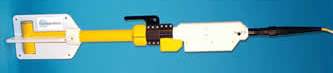
Marine magnetometers detect variations in the earth’s total magnetic field. These variations may be caused by the presence of ferrous material on or under the seabed, geological features or diurnal variations in the earth’s magnetic field due to solar activity. Marine magnetic surveying has become a standard technique for mapping the location of ferrous material on the seabed.
Magnetometers are usually towed behind the survey vessel at a sufficient distance to avoid any magnetic disturbance caused by the survey vessel itself.
OIC supports magnetometers both as auxiliary instruments (in addition to a primary sidescan or multibeam) in GeoDAS-PC, and as stand-alone instruments via GeoDAS-LT.