
© 2013 Oceanic Imaging Consultants, Inc.
Service + Software for Seafloor Mapping

Archive / 2006

September 2006
Oceanic Imaging Consultants Inc., completed sea trials in late August for the new Generic Digital version of its geophysical data acquisition software, GeoDAS-GD™. This new release differs from previous versions of GeoDAS in its ability to support multiple sensors from within one installation. Current sensors supported by GeoDAS-GD include the Teledyne-Benthos SIS-1624/25™, C-MAX CM2™, DSME Utech S-150™, EdgeTech 4200™, Imagenex Yellowfin™, Klein 3000/5000™ and the new Teledyne-Benthos C3D™ bathymetric imaging system.
The GeoDAS-GD software was used in Orange Beach, Alabama from August 25 to August 27, 2006 during system trials for NAVOCEANO (U.S. Naval Oceanographic Office), utilizing Teledyne-Benthos, EdgeTech and Klein sidescan sonars back to back over a purpose-built target range in the Gulf of Mexico. Targets ranging in size from five gallon buckets to fish-traps measuring two feet per side, were arranged in a line in water depth of approximately 15 meters, and imaged at ranges from 25 to 150 meters, at speeds from 4 to 10 knots.
GeoDAS-GD provided a common control, logging and display interface to all the sonars, allowing unbiased comparison of performance via a common presentation interface. The OIC Extensible Record Format automatically accommodated variations in the raw sensor data dynamic range, efficiently accommodating 8, 12, 16 and 24-bit data without arbitrary compression/clipping or waste of storage space.
GeoDAS-GD supports all standard features of GeoDAS, including control, logging, processing,
targeting, databasing and real-time mosaicking, plus new SmartSonar™ auto-tuning
and
auto-targeting tools.
July 2006
Oceanic Imaging Consultants Adds Support For Teledyne Benthos
Oceanic Imaging Consultants Inc., has today certified for release the latest version of its geophysical data acquisition software, GeoDAS, for use with both the Teledyne Benthos C3D and Teledyne Benthos 1600 Series sidescan systems. The new GeoDAS release supports acquisition, real-time processing and display of both imagery and bathymetry from the C3D system, as well as the sidescan (CW or Chirp) and sub-bottom from the 1600 Series.
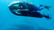
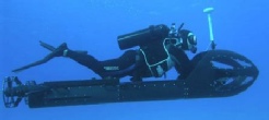
The GeoDAS software and C3D sonar were used this past month in the mapping of the so-called "Ordnance Reef" off the west coast of Oahu, as part of a DoD/NOAA effort to characterize a known munitions disposal area. The survey team, consisting of members from NOAA's National Marine Sanctuary Program, National Marine Fisheries Service, Teledyne-Benthos and OIC, mapped an area of 4 square KM in water depths from 5 meters to 50 in two 10-hour days, producing a 50 cm resolution bathymetric map, and a 10 cm resolution sidescan mosaic. The sidescan imagery was in subsequent days continued to deeper waters, using the new dual-frequency Teledyne Benthos SIS1624 sidescan, adding another 4 square KM, and covering targets in waters from 50 to 100 meters depth. Support for the new Teledyne Benthos sonars is available in a specific release of GeoDAS-TBI (Teledyne-Benthos, Inc.).