
© 2013 Oceanic Imaging Consultants, Inc.

Service + Software for Seafloor Mapping

Sector Scan Sonars / Overview

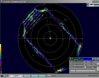
Sector scan sonars provide radial coverage around a vehicle, usually for collision avoidance purposes. Their traditional display is most familiar to us as a PPI (plan position indicator) or “radar-scope” format image, showing radial range and direction to targets, with strong targets showing up as “blips”.
GeoDAS supports Sector Scan sonars via GeoDAS-PPI, which allows not only control and traditional PPI display, but also full geocoding and real-time mosaicking of the sector-scan data.
GeoDAS
GeoDAS-DT
GeoDAS-FLS
GeoDAS-LT
GeoDAS-MB
GeoDAS-MPE
GeoDAS-SDV
OIC-Class
OIC-CleanSweep
OIC-HullSweep
OIC_NAP
OIC_Pipetrack
OIC_Toolkit
OIC_ROVer's Eye
HMS-1400
SAMM