

© 2013 Oceanic Imaging Consultants, Inc.
Service + Software for Seafloor Mapping

Archive / 2011
Social Media

April 2011
Mind the GAP!
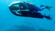
Just this past month, OIC completed integration support for the BlueView forward looking sonar system within our GeoDAS-GD (generic digital) product line. This allows customers to either support the BlueView alone, with all the geocoding, target marking and real-time mosaicking always offered in GeoDAS, or in concert with any traditional sidescan, to provide a nadir gap-filling capability. GeoDAS automatically determines the size of the sidescan nadir gap, and samples optimally from available forward look data to FILL THE GAP. This translates to NO MORE HOLIDAYS, and no time wasted running extra survey lines.
April 2011
OIC has continued to expand the list of supported sensors and data formats. Recently, we have added the following to the list of data formats/sensors supported by our data processing product, CleanSweep:
- GeoAcoustics GeoSwath Plus (.rdf)
- Marine Sonics HDS (.sds)
- Klein 5000 v2 and Klein 3900 (.sdf)
- Reson 7k series (.s7k)
On the data acquisition side, GeoDAS is now capable of acquire/controlling the following sensors:
- BlueView P450-45
- R2Sonic Sonic 2024
- Tritech Starfish
- Ultra Electronics FLS
March 2011
In March of this year, OIC delivered to Johns Hopkins University the first official release of our latest software product, GeoDAS-FLS. Imagery, bathymetry, and waterfall displays, a full suite of sonar controls and processing options, and an advanced targeting module, all packaged in a clean and easy to use interface, make GeoDAS-FLS a powerful software, capable of acquiring data from BlueView, Imagenex, R2Sonic, Sonavision, Tritech and Ultra sensors.