| |
| |
 |
| Review any OIC product by selecting it from the menu below |
| |
|
|
 |
| Choose from the dropdown menus below to learn about OIC supported sensor types |
| |
|
|
 |
| Click on the dropdown menu below to find out more about the services OIC offers. |
| |
|
| |
|
|
|
 |
|
|
| Home
» About OIC »
Company Background |
|
| Oceanic
Imaging Consultants |
| |
Oceanic Imaging Consultants, Inc. was founded
in 1993 as a spin-off of research done for the Office of Naval
Research at the University of Hawaii. OIC produces a wide range
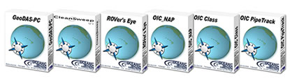
of hydrographic software systems including the GeoDAS
series, CleanSweep, ROVer’s
Eye, OICclass and PipeTrack. OIC strives
to bring to clients the critical solutions to any seafloor imaging
problems, leading the industry in providing expertise and quality
in products and service. |
| |
Software Products |
| |
OIC is a full-service company; we pride ourselves
on having expertise that comes from decades of hands-on surveying
experience. |
| |
 |
| |
As a complement to our software products, OIC
provides consulting and data processing services pertaining
to seafloor mapping, including scientific analysis and interpretation
of sonar data, and creation of mapping products. OIC also assembles
client-specific turnkey systems including OIC software bundled
with a workstation and/or sonar of the client’s choosing.
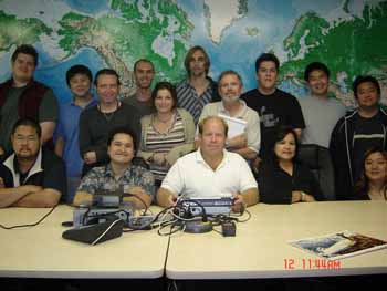
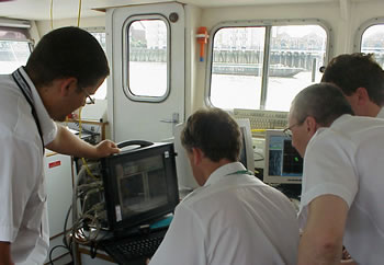
Finally, OIC offers supervised training in our office, at sea,
or at a location of the client’s choosing. |
| |
 |
| |
|
| |
SOFTWARE PRODUCTS AND SERVICES
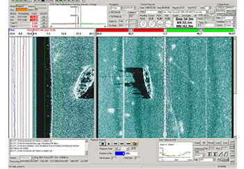
OIC’s flagship product is GeoDAS,
a Geophysical Data Acquisition System, that features simultaneous
collection of up to 8 channels of data; real-time processing
and mosaicking; superimposed charts to show navigation and
area coverage; the target view tool that makes target marking
and identification one-click easy. |
| |
GeoDAS |
| |
Our GeoDAS software comes custom-configured
for individual client needs, including GeoDAS-MB
for multibeam sensors, GeoDAS-LT for serial
devices such as fathometers, magnetometers and sidescan sensors,
GeoDAS-GA for analog sidescan sensors, GeoDAS-GS
for sensors with serial port connections, and GeoDAS-DT
for playback, reprocessing and mosaicking. OIC is currently
implementing new GeoDAS tools: AutoSonarTM, SmartGainsTM and
SmartTargetingTM software options to automate survey data acquisition,
execution and interpretation. CleanSweep provides a turnkey
solution for post-processing sidescan and bathymetry data, producing
publication-quality digital mosaics from raw sonar data. |
| |
CleanSweep can import data
from all major sonar systems, remove water column, process
navigation and attitude, correct beam patterns, enhance imagery,
mosaic the data, and export the final image to other GIS and
mapping packages. |
| |
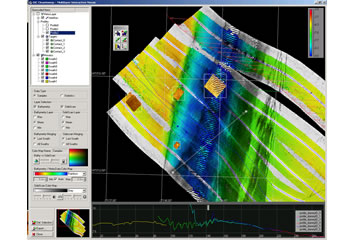
CleanSweep |
| |
ROVer’s Eye is a PC-based
real-time 3-D virtual reality package designed to help underwater
vehicle operators navigate the seabed terrain and avoid unseen
hazards. 30 frame-per-second rendering, sidescan and bathy overlays |
| |
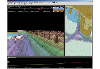
ROVer's Eye |
| |
OICclass is a Windows-based
tool for analysis and classification of sidescan and swath bathymetry
data. |
| |
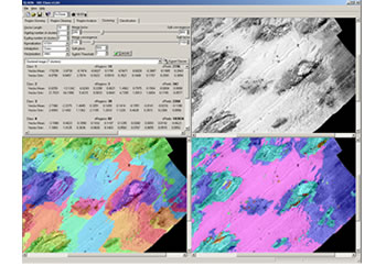
OICclass |
| |
OICpipetrack is our automatic
pipeline tracking, free-span detection and reporting software
tool. |
| |

OICpipetrack |
| |
OIC also provides survey support, software training,
consulting and data processing services. Contact
us for more information! |
|
|