Oceanic Imaging Consultants
Home Contact
 
   
Overview
Acquisition
Display Configuration
Sidescan Processing
Bathy Processing
Targeting
Mosaicking
Survey Management
Advanced Survey Management
Mission Products
GeoDAS Modules
Supported Sensors
Specification Sheet
 
 
Software
Review any OIC product by selecting it from the menu below
 
Devices
Choose from the dropdown menus below to learn about OIC supported sensor types
 

Services
Click on the dropdown menu below to find out more about the services OIC offers.
 
 
Home » Products » Software » GeoDAS
GeoDAS
  SIDESCAN PROCESSING


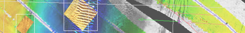
GeoDAS processing controls allow on-screen, real-time solutions to low contrast, systemic artifacts and geometric distortions. Correct slant-range and ground-range distortion, improve dynamic range, and correct for backscatter.

 
Read more about GeoDAS.
  View a variety of data samples processed by GeoDAS.
  Learn which sensors GeoDAS supports.
  Download GeoDAS Spec sheets