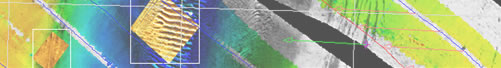
CleanSweep
Post-Acquisition Processing for Sidescan and Bathymetry
CleanSweep is the state of the art post-acquisition software package for imagery and bathymetry data processing. CleanSweep integrates all the essential features for your processing needs:Advanced Navigation, imagery and bathymetry processing tools, 2D waterfall, 2D multilayer mosaic, 3D editor, target database and much more.
CleanSweep reads OIC, XTF, Edgetech™ JSF, all Seabat data, Simrad packets, Klein™ SDF, HSX, MST™, Imagenex™ 872 data formats
Bathymetry Processing
- Support Multibeam and Interferometry acoustic data
- Motion compensation
- Beam filtering ( angle/depth/ground range )
- Advanced quality assertion filtering ( sweep-wide quality profile, linear fit )
- 3D Swath Viewer: point cloud, profile lines, surface with sidescan draped-over rendering
- 2D/3D editing tools
- Beam refraction correction using sound velocity profile
Navigation/Attitude Processing
- Latency, bias/scale corrections
- Noise rejection filters and navigation outliers editing
- Processed navigation export
- Mount-Offsets correction
- Towfish layback computation
- Exclusive navigation correction based on imagery ( InterNav )
SideScan Processing / Targeting
- Advanced beam pattern correction
- Hardware gain change smoothing
- Contract Enhancement
- Along-track interpolation of processing gains for a seamless mosaic
- Time varying gain compensation (TVG)
- Slant range, ground range and bathymetry backscatter angle trimming
- Advance targeting module
- Create geo-corrected targets with actual size and orientation
- Easy drag-and-drop target marking/classification
- Height from shadow measurement tool
- XML/GeoTiff import/export
- Full HTML report with image and meta-data
GeoCoding and Mosaicking
- Exclusive interactive mosaic allows for real-time composition of the mosaic. No need to reprocess all of the data set, swaths can be merged, layed or removed from the final mosaic interactively
- Multi-resolution imagery / bathymetry overlay
- Background charts in both vector (DNC, ENC/S-57, DXF, VPF) and raster formats (BSB, GeoTiff)
- Statistical quality control
- Multi-layer display on the mosaic: Targets, images, survey tracks, longitude/Latitude grid
- Multi-point bathymetry profiles can be created directly on the mosaic
- Advanced export tools
- Easy click-and-drag export area definition
- High resoltuion export file can be automatically tessellated for easier handling
- Export to GeoTiff(8/24 Bits), GRD grid, ASCII XYZ, ASCII LLZ, OIC grid
- Repeat surveys made easy with the survey area tessellation tool
- Chart Output to PostScript for easy printing, contouring and surfacing

