| |
|
| |
| |
 |
| Review any OIC product by selecting it from the menu below |
| |
|
|
 |
| Choose from the dropdown menus below to learn about OIC supported sensor types |
| |
|
|
 |
| Click on the dropdown menu below to find out more about the services OIC offers. |
| |
|
| |
|
|
|
 |
|
|
| Home
» Products
» Software
» GeoDAS-LT |
|
| GeoDAS-LT |
| |
OVERVIEW |
| |
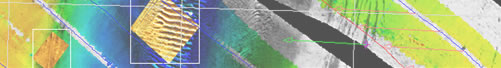
GeoDAS-LT can also support digital sidescans with data over a serial interface, such as the Imagenex SportScan series, S-150, C-MAX CM2, Tritech SeaKing and others, providing all the usual advanced GeoDAS processing at a rock-bottom price. |
| |
FEATURES |
| |
- Survey Management and Nav Tracks
- Real-time mosaicking of depth, Mag, seabed type
- Target marking, analysis, mensuration
- Mission products (contour maps, target maps, etc.)
|
| |
SUPPORTED SYSTEMS |
| |
Single-beam Systems
Magnetometers
Survey Sensors
- Any NMEA GPS/gyro - Contact us for details on supported systems
- LBL & USBL systems Contact us for details on supported systems
- Most Fathometers Contact us for details on supported systems
- Most motion sensors Contact us for details on supported systems
Seafloor Classification
|
|
|