| |
| |
 |
| Review any OIC product by selecting it from the menu below |
| |
|
|
 |
| Choose from the dropdown menus below to learn about OIC supported sensor types |
| |
|
|
 |
| Click on the dropdown menu below to find out more about the services OIC offers. |
| |
|
| |
|
|
|
 |
|
|
| Home
» Data Samples »
Interferometric SS/Bathy |
|
| Interferometric
Bathymetry Mosaic Data Samples |
| |
Below is a list of Interferometric
Bathymetry sonars currently supported by OIC products, along with sample
data for each sonar type. |
| |
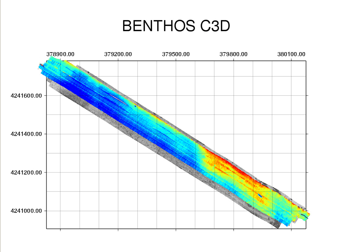
CAPE COD CANAL, MA, USA |
| |
The Teledyne Benthos C3D seafloor mapping system is made by Teledyne Benthos Inc., of North Falmouth, Massachusetts.
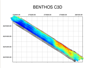
Shown here is combined sidescan and swath bathymetry from the Teledyne Benthos C-3D system. Data covers an area of the Cape Cod Canal, including a sunken barge, in the lower right of the image. For an aerial view, click here. Data compliments of Francois LeRoy, Teledyne Benthos. |
| |
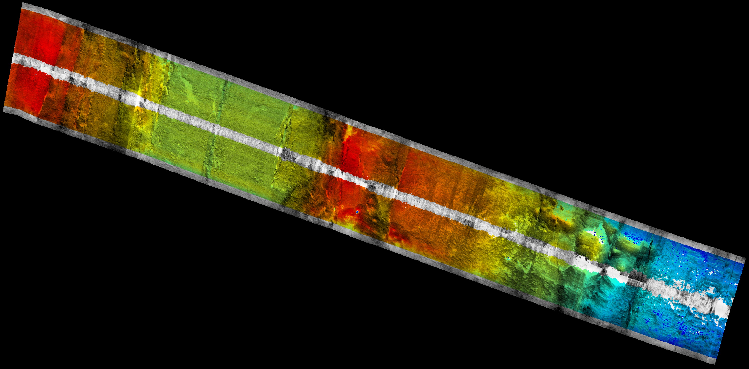
CLEFT OF JUAN DE FUCA RIDGE |
| |
The DSL-120 is owned and operated by the Deep Submergence Lab of the Woods Hole Oceanographic Institute, Woods Hole, MA.
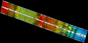
Combined sidescan and interferometric swath bathymetry data from the Woods Hole Oceanographic Deep Submergence Lab's DSL-120 system. Data, complements of Debra Stakes of MBARI, were collected from the "Cleft" segment of the Juan de Fuca Ridge, near its intersection with the Blanco Fracture zone. |
| |
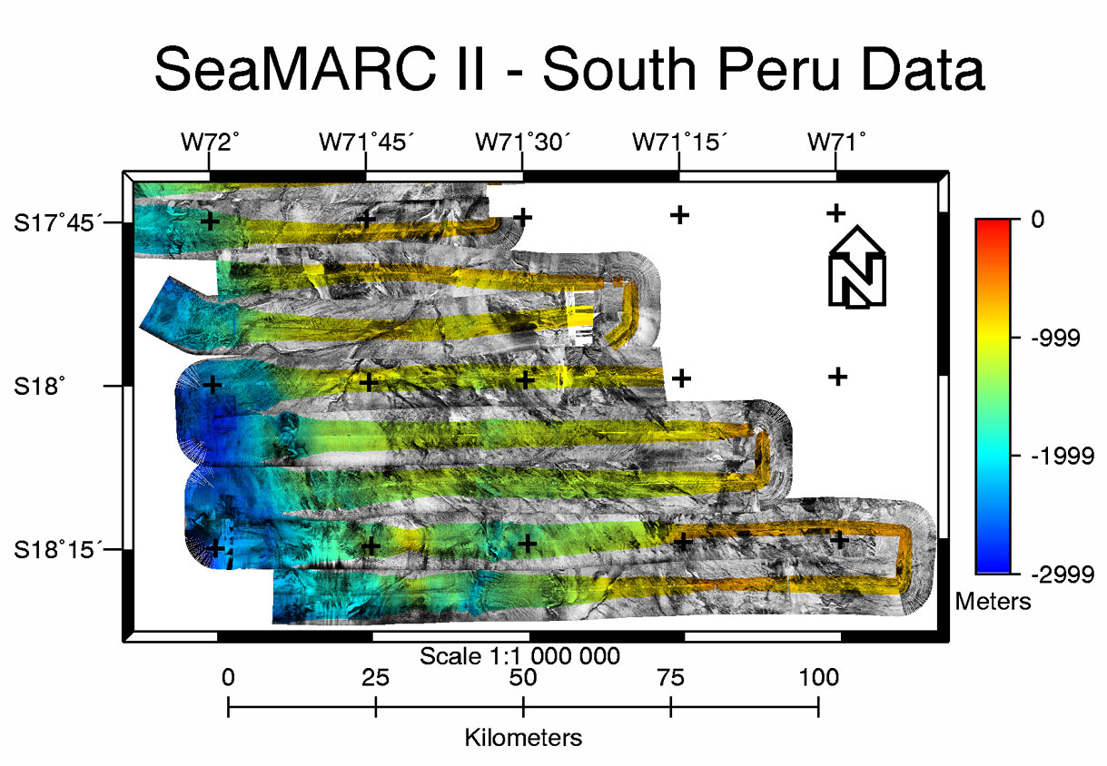
SOUTH PERU |
| |
The SeaMARC II was co-created by the University of Hawaii and the Raytheon Company.
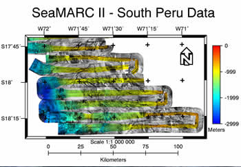
SeaMARC II data were converted to OIC format on UNIX and processed in GeoDAS-Desktop at 100-m resolution. Map annotations were added in ER Mapper.
|
| |
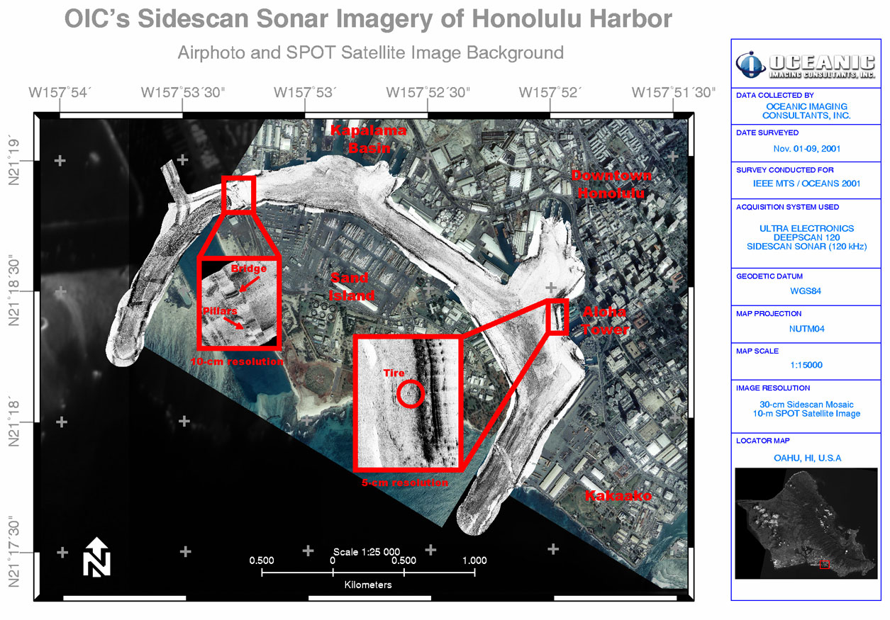
HONOLULU HARBOR, HI |
| |
The UEOS Deepscan is produced by Ultra Electronics Ocean System of Middlesex, England.
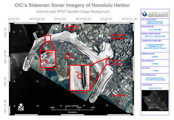
UEOS Deepscan data were collected for demo during IEEE MTS / OCEANS 2001. The data were processed at 30-cm resolution in GeoDAS-Desktop and superimposed over air photo image and SPOT satellite image in ER Mapper. Higher resolution mosaic images (5-cm and 10-cm) were inserted for close-up target display.
To return to the Sensor Samples main page, click here.
|
|
|