
© 2013 Oceanic Imaging Consultants, Inc.
Service + Software for Seafloor Mapping

OIC Projects
Preliminary analysis showed the objects were cylindrical objects measuring about 0.5 meters in diameter and standing about one meter tall. The location of the features was handed off to the US Coast Guard’s remotely operated vehicle (ROV) team. Based on the information provided by OIC, the ROV team was able to deploy and promptly navigate the ROV to the targets. Cameras attached to the ROV provided visual confirmation that the targets were actually two 55 gallon drums filled with an unknown substance.
In all, OIC was able to mobilize the survey vessel, conduct the survey, identify the targets, and deliver the coordinates to the USCG dive team in less than two hours.
1. Kaimalu O Hawaii –Terrorism Preparedness Exercise, Pier 19 Honolulu Harbor, Hawaii
2. High Resolution Sidescan/ Bathemetry Survey of Waiau Cooling Basin, Honolulu, Hawaii
3. SeaWater Air Conditioning Pipeline Route, Bora Bora, French Polynesia
4. SeaWater Air Conditioning Pipeline Route, Curaçao, Netherlands Antilles
5. Santa Monica Basin Cable Route Survey, Santa Monica, California
6. Atlantic-Mediterranean
Segment Submarine Cable System, Principality of Monaco
7. STARS – NAVFAC Deep-Towed Sonar Survey off the Coast of California
8. Chevron Typhoon Survey,
Gulf of Mexico
9. NOAA Ordnance Reef Survey,
Five Miles off Pokai Bay, Waianae, Hawaii
10. Shell Shallow Water Geohazard Survey, Beaufort Sea, Alaska

Project 1.
Kaimalu O Hawaii –Terrorism Preparedness Exercise
Pier 19 Honolulu Harbor,
Hawaii
Project Owner: US Coast Guard, District 14
Prime: Yes
Subcontract: No
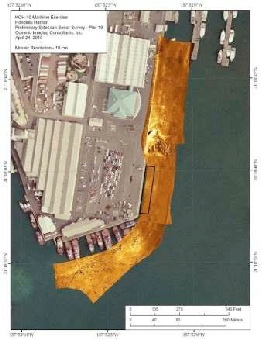
In April of 2010, OIC participated in a terrorism response exercise in Honolulu Harbor using our seafloor mapping capabilities to find and identify potentially hazardous objects in the harbor. The Kaimalu O Hawaii terrorism preparedness exercise involved collaboration between Federal, state, and local law enforcement and emergency responders, and was designed to test existing security response plans and procedures.
As part of the exercise, OIC provided a rapid-response survey of the harbor in the vicinity of staged terrorist activity. Utilizing the highly portable HMS-1400 sidescan sonar system, and the OIC Pontoon survey vessel, OIC quickly acquired and analyzed the data. By comparing the newly acquired survey data with a baseline dataset, OIC data processors identified two new, conspicuously placed features adjacent to Pier 19.